Say you’re an agricultural scientist, and you know there’s technology out there that could be a game-changer in your research. But its application in agriculture is still relatively new, so finding someone who can help you use it is challenging.
That’s the case with thermal remote sensing technology — equipping drones or unmanned aerial vehicles (UAVs) with thermal sensors that produce images of fields based on temperature, and processing that data for researchers to analyze and apply.
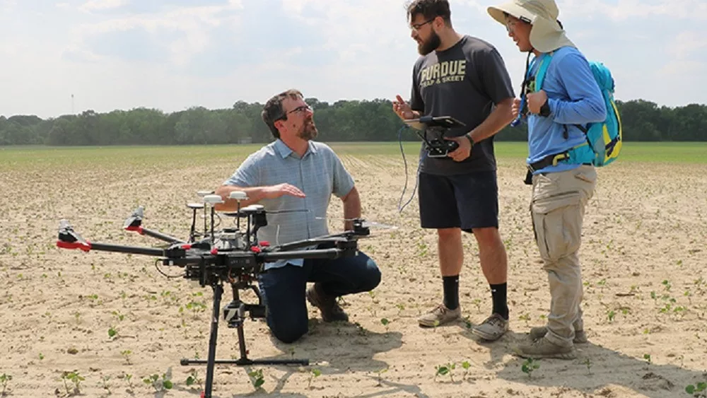
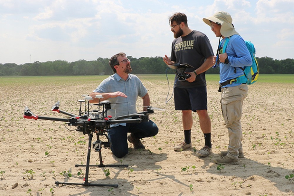
Purdue’s Plant Sciences team has now established a protocol to enable application of UAV-based remote sensing thermal imaging. The protocol takes advantage of the innovative UAV technologies provided by GRYFN, a company founded at Purdue, and is capable of providing information-rich data for scientists in different disciplines.
“Our goal is to establish a protocol that agriculture researchers can rely on,” says Sungchan “Sun” Oh, computational infrastructure specialist on the Plant Sciences team led by Mitch Tuinstra, Wickersham Chair of Excellence in Agricultural Research and scientific director of Purdue’s Institute for Plant Sciences, and Yang Yang, director of digital phenomics.
Many agricultural researchers have adopted remote sensing technologies in which UAVs carry sensors that allow them to not only view fields from the air but also measure the structural and functional characteristics of crops. Their usefulness is applicable to a wide range of areas that the researchers study — plant varieties, irrigation, different fertilizers or pesticides, and many more.
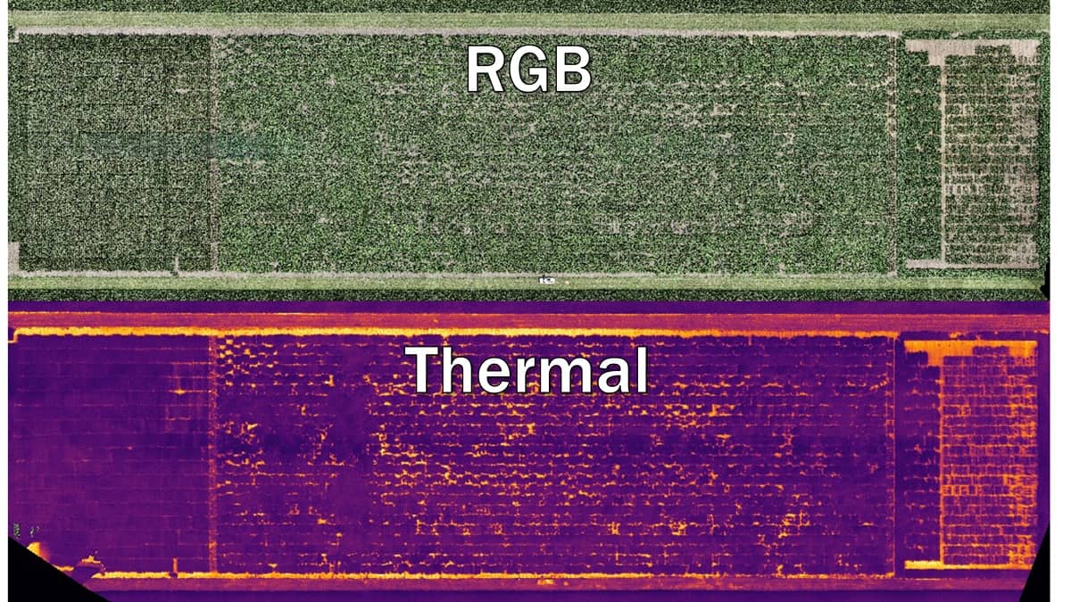
For applications in agriculture, reliable processing protocols have made RGB and LiDAR the go-to UAV-based sensors. From RGB remote sensing, measurements show how green the plot is. LiDAR measures detailed geometric properties, like plant height or volume. However, applying thermal sensors to reliably measure the surface temperature of a target, which cannot be assessed by visual observation, has been more challenging.
Thermal properties of a crop cannot be extracted from other remote sensors such as the RGB imager or LiDAR. Thermal images also look different, so transforming the raw thermal data into a human-friendly format requires carefully established processes.
Thermal imaging
“After several intricate steps, we can finally measure temperature using the acquired thermal images of a target. Think of it like measuring temperature with your eyes,” Oh explains. “Brighter colors like orange mean higher temperatures, while darker ones such as indigo or purple represent areas of lower temperatures. We just do it almost automatically with our processing algorithm.”
Based on the thermal measurements, a researcher investigates the correlation between their interests of research — for example, amount of fertilizer or different corn varieties — with temperature.
Temperature information is crucial because it is closely related to a plant’s health status and performance. “It can be associated with a corn plant’s height, leaf size, growth rate, yield, and even taste. Temperature could also be the key to reveal underlying reasons why some varieties do well in a certain difficult conditions, while others don’t,” Oh explains.
Researchers are still learning how to apply thermal data to their own studies. “Our Plant Sciences team is trying to become a bridge between the agricultural scientist and the technologies behind the scene,” Oh says. “We’re trying to provide accurate, usable, actionable data for agricultural researchers.”
Their goal is not a sophisticated product, he adds: “Our protocol is trying to create a thermal data product that researchers can easily use with prior knowledge and skills.”
At Purdue, users and potential users are mostly scientists in Purdue Agriculture or third-party companies that do not have remote-sensing platforms and sensors. “However, we are ready to work with anyone who wants to figure out how plants adjust to the changing environment,” Oh says.
To create thermal data products for users, the Plant Sciences team first flies drones over the research plots and brings the raw data from the UAV to a computer work station. Data processing converts raw data into thermal properties in image format. The next step is extracting thermal information from each plot and summarizing it as a table. The team then advises the researcher how to use the data products for their analysis.
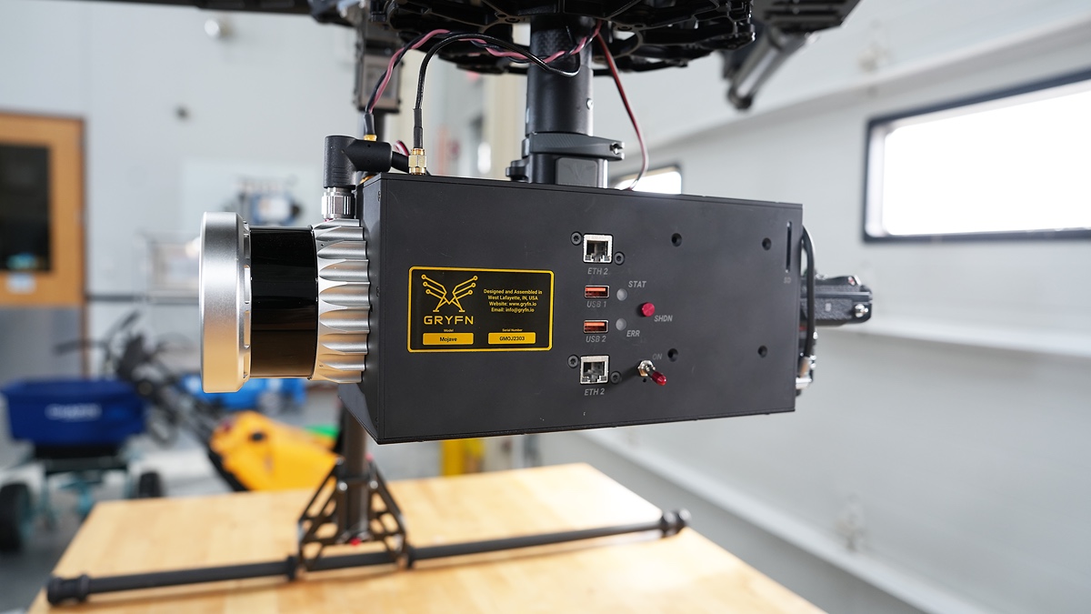
GRYFN technology
GRYFN is critical to the protocol, Oh says. “GRYFN uses high-end sensors for accurate measurement. When we load the data product from the GRYFN platform, it accurately co-registers with Google maps or satellite images, and it makes it easy to monitor thermal properties of a plot during the season.”
Researchers at different universities and research institutes are also developing thermal remote sensing protocols, Oh says. “We are one of them, because there’s no golden standard method to processing data yet.”
GRYFN, too, is developing its own protocols, not only with thermal but also with RGB or other remote sensors. “We’re actively discussing how our team and the GRYFN team can work together to make the thermal sensing protocol more user-friendly,” Oh says.
Click HERE to learn more about Purdue-based ag startup company GRYFN.
Written by Nancy Alexander, Purdue Agricultural Communications.